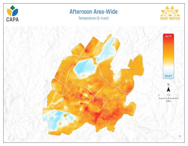
Staff working on climate action issues in Charlottesville have published the results of a survey conducted last summer to map out temperature and humidity levels across the city.
“How urban environments and neighborhoods are built affects the amount of heat absorbed and retained, which can increase or reduce the impact of extreme heat events,” reads a page on the city’s climate protection website. “Increases in extreme heat are one of the top projected impacts Charlottesville will experience from climate change.”
Areas with more concrete and less tree cover retain the heat from the previous day and the survey sought to document how this manifests in temperature differentials across the city’s neighborhoods. Thirteen volunteers took 34,401 measurements across the city on August 24, 2021, walking seven routes.
The map shows a clear difference between neighborhoods on either side of West Main Street which are much hotter than those such as Fifeville which have a much greater tree cover.
You can learn more about the project on the city’s Climate Action website.
Discover more from Information Charlottesville
Subscribe to get the latest posts sent to your email.