


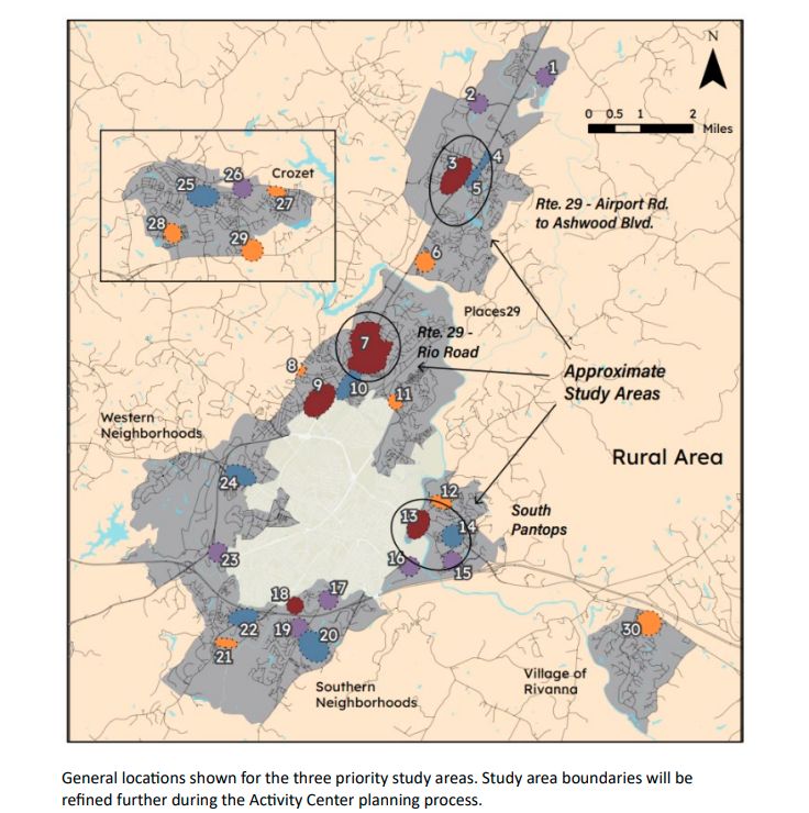
One of the purposes of a Comprehensive Plan is to direct government resources into specific areas in order to maximize investment in infrastructure. For over forty years, Albemarle County has envisioned an urban area that gets the vast majority of capital dollars. Pantops is one of the designated growth areas, as is the area around the intersection of Rio Road and U.S. 29. (Rio Corridor Public Input page)
For the past year, Albemarle has been working on a plan to address traffic congestion and a lack of walkability on Rio Road East in and around the intersection with the John Warner Parkway. They hired the firm Line and Grade to do the work which is being done in two phases.

The first extends from the Rio Road / U.S. 29 intersection to the John Warner Parkway and a written draft is nearing completion. The second phase travels down Rio Road East to the border with Charlottesville.
The Places29-Rio Community Advisory Committee got an update on January 27 from Dan Hyer of Line and Grade. Specifically he focused on the area of East Rio Road between the Parkway and Pen Park Road. Let’s hear some traffic counts. (watch the meeting)
“And what we see is that this portion of Rio Road is at least as of the year 2019 carrying about 9,300 vehicles a day,” Hyer said. “We’re seeing that Pen Park Road carries about 4,400, Pen Park Lane which goes to Lochlyn Hills carries about a thousand. The John Warner Parkway carrying around 19,800. Dunlora Drive carries about 2,400 vehicles per day.”
Hyer said those figures are likely out of date with more development in the area.
“Lochlyn Hills has continued to develop and bring more vehicles and more neighbors and more residents in the area,” Hyer said. “The Lofts apartment has come online with it, again, more neighbors, more residents, high density, multifamily there.Dunlora Park has come online.”
Hyer also the 43-unit Rio Commons project will be developed by-right on land already zoned R-4 just north of the Waldorf School. That will add another 300 vehicles a day.
There’s also another by-right development of a farm nearby that could see many more units. Before Hyer was able to get into the details of what phase 2 might look like, members of the CAC questioned his traffic data. One wanted to know what the limits are to development.
“At what point would traffic lead to so much that further development would be prohibited?” asked Audrey Kocher, who is serving in her third term on the Places29-Rio CAC.
Hyer said development is based on land use decisions made by the locality so if land is already zoned for houses, the developer as a property right to build.
“It has nothing to do with how much traffic is or is not on on the road already,” Hyer said.
“Whoa!” Kocher exclaimed. “So we can just have a really crowded, dangerous situation.”
The point of the plan is to address those public safety concerns in advance of future development. So far, crash data from the Virginia Department of Transportation does not indicate any fatalities.

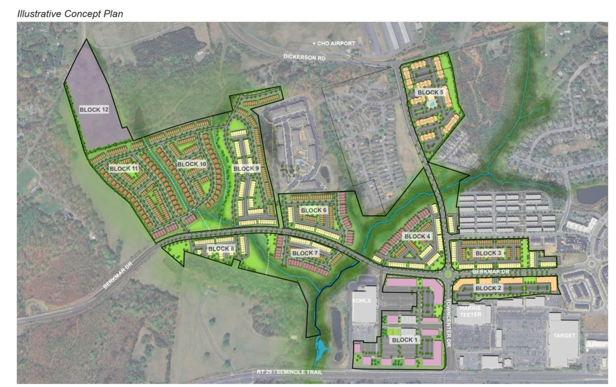
In the future, though, there will be a lot more activity on a 2,000 linear feet stretch of Rio Road East with the 328-unit Rio Point development approved by Board of Supervisors in December. The study is intended to bring it all together for the future.
“The roadway is going from this to this and so its getting increasingly dense and increasingly complex and our recommendations need to consider this and account for this,” Hyer said.
Hyer said the Rio Point project provides an opportunity to increase non vehicular access via the greenway that runs along the John Warner Parkway.
“You can see that if that connection is successfully put in, it would be really helpful for someone who lives in Dunlora Forest and wants to get to the greenway, it might make it a little easier than going through the John Warner Parkway or going down to Pen Park,” Hyer said.
There’s also a roundabout funded and planned for the intersection of the parkway and East Rio Road. The work of Line and Grade is intended to inform how the rest of the corridor might look in the future. Phase two is still in the idea phase.
“If we want to bring unity to this stretch of road, which is happening, how do we do it?” Hyer asked. “What are the opportunities? And what is the desire?”
CAC member Nancy Hunt liked what she saw in Hyer’s presentation because she sees further growth as inevitable.
“We’re going to have more traffic,” Hunt said. “This is an urbanizing area and we have to treat all property owners equally. And if we give dense zoning to one, we need to look at the possibility of giving dense zoning to another.”
Hunt said she wants speed limits on East Rio Road to be reduced to make it safer for other road users.
Fellow CAC Member Judy Schlussel took issue with one image that showed a median on East Rio Road.
“I find that as a red flag,” Schlussel said. “We all know now median strips are not maintained and it worries me that if you’re going to put this lovely greenery in, one, who is going to ultimately be responsible for the maintenance.”
You can also get a sense of where things are in a January 26 newsletter.
Before you go: The time to write and research of this article is covered by paid subscribers to Charlottesville Community Engagement. In fact, this particular installment comes from the February 3, 2022 edition of the program. To ensure this research can be sustained, please consider becoming a paid subscriber or contributing monthly through Patreon.
Discover more from Information Charlottesville
Subscribe to get the latest posts sent to your email.
One thought on “Places29-Rio group reviews corridor plan for Rio Road”