As Albemarle and Charlottesville continue to plan for urban areas where more people walk and bike, that will mean doing more to improve safety at intersections where they might encounter conflict with vehicles.
“When we look at the data that we have in Virginia, what we see is over 25 fatalities and over a third of all serious injuries are at intersections,” said Michael Fontaine with the Virginia Transportation Research Council. “And those numbers are even higher for bicyclists and pedestrians.”
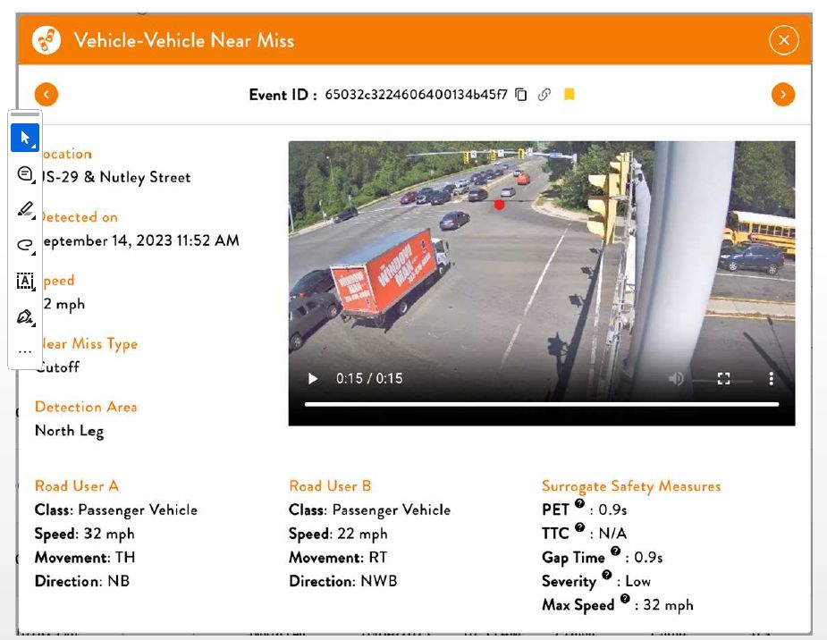
Fontaine is working on a team to test out new technology that allows for intersections to be studied via LIDAR and other techniques to study how they are used in real time.
“Rather than just detecting whether something is stopped waiting to use the intersection or not, we can actually track trajectories of vehicles as they traverse the intersection,” Fontaine said. “”What this does is this new technology kind of opens up a lot of opportunities for us where instead of waiting for a crash to occur, this allows us to look at near misses that are happening in the vicinity of the intersection.”
He said the data can help plan for better intersections and perhaps ones that can warn drivers of impending collisions with people on bikes or on foot. The General Assembly has allocated $1 million to an Innovation and Technology Transportation Fund to fund pilot projects to advance new ideas. A first phase tested out four technologies and tried them out at two intersections in Fairfax County.

Fontaine presented information on the first phase to members of the Charlottesville Albemarle Metropolitan Planning Organization.
“You can foresee a case where, if we have a system like this, perhaps this helps us with emergency response,” Fontaine said. “If there’s a way to detect a crash in real time, maybe emergency response could be alerted, send someone to the scene a little bit faster than relying on a 911 call.”
While Fontaine said the technology might not be used for enforcement purposes, public safety officers might determine the most efficient time for officer to be on site to hand out tickets to violators.
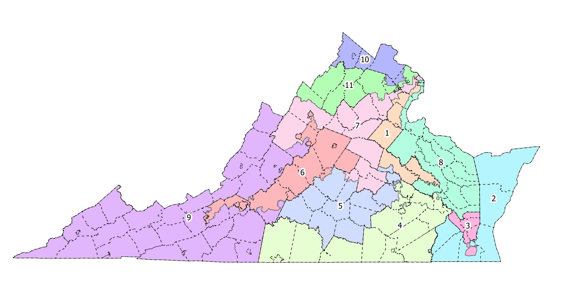
The second phase will expand testing including four intersections in Albemarle County which is within the Virginia Department of Transportation’s Culpeper District. Systems will be tested at the intersections of Alderman Road and McCormick Road, Hydraulic Road and Lambs Lane, Ivy Road and Old Ivy Road, and the grade-separated intersection of U.S. 29 and Rio Road.
“It’s a combination of looking at locations where we have pedestrian and bicyclist usage, but we also have space in our controller cabinets to house all this additional equipment,” Fontaine said.
The plan is to install the equipment by the end of the fiscal year and operate tests through January 2026.
The second phase will also include four intersections in Montgomery County. The work is being overseen by the Virginia Tech Transportation Institute.
The first phase yielded some observations such as RADAR technology overcounting traffic and LIDAR not functioning in inclement weather. So far the video-based systems appears to work most effectively.
Fontaine sought to set expectations.
“This is a technology evaluation, not a site evaluation,” Fontaine said. “I guess I do want to emphasize that we’re looking at does the technology work? We’re not using this to diagnose safety issues or anything at these intersections. Now, that being said, the data that’s being generated is going to be shared with Culpepper District. They’re going to be aware of everything that they’re seeing.”
Video will not be stored after raw data has been evaluated as VDOT has a policy to not keep recordings. While machine learning and image analytics are both being employed, Fontaine is careful to not use the letters AI.
Sean Nelson, the administrator of Albemarle’s Culpeper District, said data will likely be used to inform future improvements at the eastern intersection of Old Ivy Road and Ivy Road.
“If we implement something out there now to collect information, we would use that information to help us design the best intersection based on the habits that we saw from the data that was collected,” Nelson said.
However, there is not yet identified funding for such a project.
Before you go: Living in a civilization powered by technology can be confusing, especially when some of that technology seeks to constantly disrupt existing ways of living. Over the past several decades, local journalism has been unable to provide enough information on the changes, but this publication seeks to try at least. This particular story comes from the March 3, 2025 edition of Charlottesville Community Engagement. You can support this on Patreon but if you do so on Apple’s system, Apple gets 30 percent of the cut for doing none of the work! Pretty lousy, right? As I said, living in a civilization powered by technology can be confusing and unfair. Are there rules? Let’s hope there are more journalists asking and monitoring.
Discover more from Information Charlottesville
Subscribe to get the latest posts sent to your email.