In February 2022, Riverbend Development filed a rezoning for property around the Virginia Eagle Distribution Center to allow for hundreds of homes and thousands of square feet of commercial space.
After three and a half years, the proposal will move forward to a public hearing before the Albemarle Planning Commission on September 9.
This is a “request to rezone six (6) parcels to the Neighborhood Model District for a mixed use development including residential and non-residential uses” according to an August 21 letter sent to adjacent property owners.
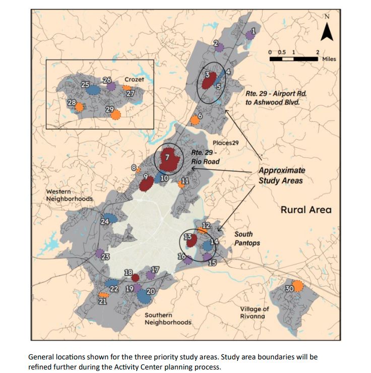
The narrative dated September 2024 assumes Albemarle County will never adjust its growth area boundaries.
“While Albemarle County continues to grow, no new land will ever be available,” reads the narrative. “Therefore, it is important to plan carefully, especially in the case of larger parcels, such as the Sieg property.”

The plan has been updated since first being submitted and after a community meeting held in August 2025. Here is some of what is in the plan dated April 21, 2025.
- The developer would pay to extend water and sewer to the site and it is within range of the jurisdictional service for the Albemarle County Service Authority.
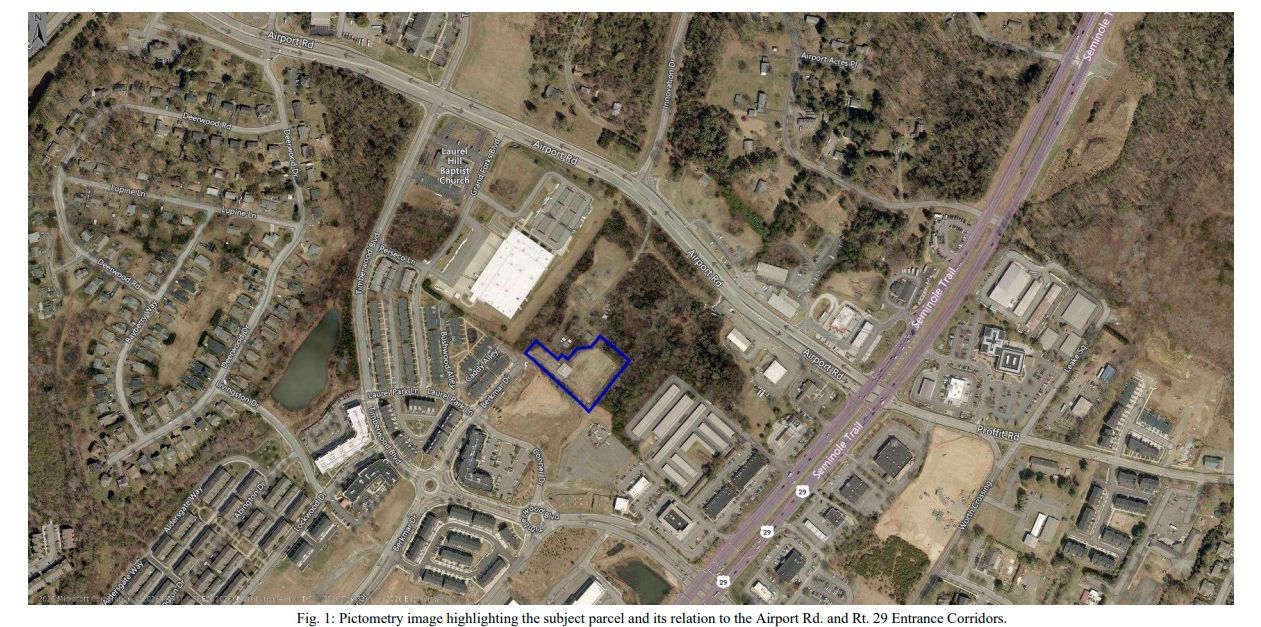
- The proposed development would consist of six blocks and be arranged around an R-shaped network of local roads. This would include the existing Gold Eagle Drive as well as a second entrance onto U.S. 29.
- The Comprehensive Plan designates two of the six parcels as Urban Density Residential and four of them as Regional Mixed Use.
- A traffic signal is planned as is a 105-foot long crosswalk across the four-lane highway.
- The area of disturbance would be 62.4 acres.
- The plans include a ten-foot wide multi-use path on U.S. 29 as well as a pedestrian crossing.
- The plans show a minimum of 100 residential units and a maximum of 1,200 units.
- The plans show a minimum of 50,000 square feet of non-residential use and a maximum of 440,000 square feet.
- A trailhead would be planned for county-owned lands to the north on the other side of Interstate 64.
Before you go: The time to write and research of this article is covered by paid subscribers to Charlottesville Community Engagement. In fact, this particular installment comes from the August 27, 2025 edition of the program. To ensure this research can be sustained, please consider becoming a paid subscriber or contributing monthly through Patreon.
Discover more from Information Charlottesville
Subscribe to get the latest posts sent to your email.